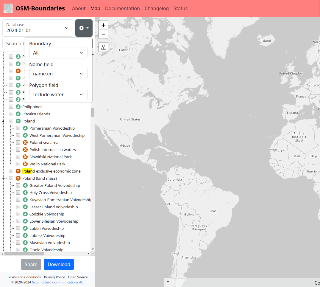
Avatar
Magnus
  • Declined
Since 2021 the site imports all polygons which has the tag boundary set. It doesn't matter what it is set to. This is by design. It was impossible to make anything useful for way too many countries with the discrepancies in OpenStreetMap otherwise Therefore these polygons should exist in OSM-Boundaries, as the design is now.

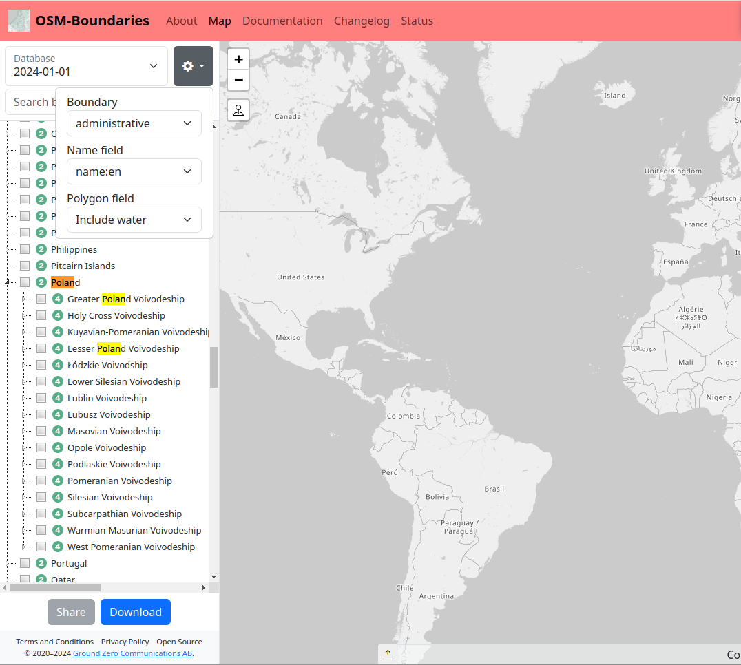
There are however major updates that are in progress. We currently have a full time employee on the site, plus myself from time to time as well. There will be a couple of changes and improvements. What will help you in this case is that we'll provide multiple variants of the tree to the left. For example one of them will be boundary=administrative only.

Sadly the updates are taking a bit longer time than I had hoped for. We are making major redesigns of the code before attacking any of the bigger features. It's an investment, making the code better, before adding new stuff. I have high hopes that we'll be able to release the first updates within a month from now. Maybe even in two weeks. Depending on a lot of things it might be that we'll provide a "beta site" first.
Avatar
PPete2

I see - in this case you could label such well-defined boundaries with a letter(s): like "PA" for protected areas, "NP" fpr national parks, "PC" for postal codes. Just keep "X" or maybe better "?" for unknown type of boundaries.

Avatar
Magnus
Quote from PPete2

I see - in this case you could label such well-defined boundaries with a letter(s): like "PA" for protected areas, "NP" fpr national parks, "PC" for postal codes. Just keep "X" or maybe better "?" for unknown type of boundaries.

I honestly don't see any reason to. I still think our coming changes will solve the issue you are having.

All boundary=administrative should have an admin level. At least from what I know. So you could just ignore all that has an X in the tree? I personally don't really find it in the scope of this project to try to differentiate arbitrary values from the boundary key. The value national_park doesn't even make it into the top 10 most used actually. There would be quite a few abbreviation that no one would understand.

What is the issue you are trying to solve? If you are looking for administrative boundaries only, that is a feature that's coming fairly soon (with alternative tree views). Out of (currently) 47 open issues in our system, I would say this is one of those that has top priority as soon as the cleaning up is done. But! It might also be that there are other issues that we have to fix first to make that implementation easier. But I have hopes for that feature being ready in our development environment in a week. No promises though.

I do however find it being a fairly good idea to start using ? as well. I am thinking like this. The icons in the currently are numbers (1-13) or a red X. It would be a fairly simple patch to use ? for all boundary=administrative that doesn't have an admin level, instead of the X they have now. That would be 1664 out of 672498 polygons changing icon in osm20231106 (I had that DB open in my shell). I would guess that most of those 1664 are fairly small and far down in the hierarchy though, but that's just a guess. I will go ahead and create an issue for this, so that we keep track of it.

Avatar
PPete2

I personally don't have an "issue" - that's the reason I posted it within "ideas" and not "bugs" or something ;-)

I think it would be an improvement to the users of your site to see at first sight if a boundary is an admin-boundary, what admin-level it has (already possible). Or if a yet-X-boundary is a certain well-know not-admin boundary like protected areas or postal areas.
Each remaining (not well-known or misstagged) boundaries could be taggeg with "X" or "?"

Right now each Not-Admin boundary is labeled with "X". Not an issue, but could be improved by different labels.

Avatar
Magnus

Thanks. We'll look into this for sure. I will have to refresh my memory a bit on how things work and such. But an issue has been created and I will most likely take a look later today.

I also think that updating the documentation is important to be honest. Right now it's a lot of rambling and old things are mixed with new. To be honest we mostly threw together a lot of texts to satisfy Google. We have plans to clean this up as well the coming 1-2 months.

Avatar
Magnus

Major changes are soon to come to the site. One of the changes is a boundary=administrative filter. It has been a lot more work than expected though.

Image 30

Image 31

Avatar
PPete2

Cool, Thanks a lot for your efforts!