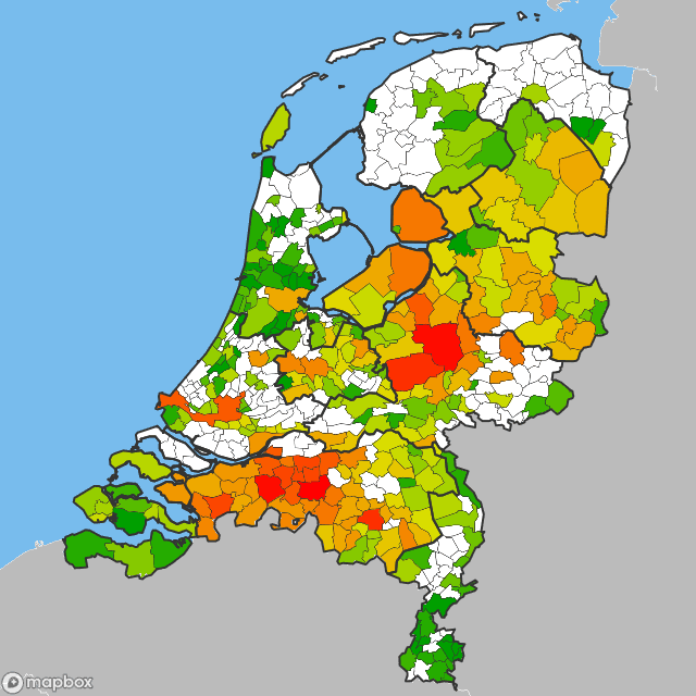
Exclude large waterbodies
Hello Magnus,
Perhaps, you remember my e-mail about using google charts for maps (more than seven years so I don't blame you if you don't remember). Since then I've developed an alternative using mapbox and shapefiles. See http://mapboxutil.technetium.be. When searching for up to date shapefiles I found this site. I'd like to compliment for this great site.
So far the praise part, now the Idea.
You have already an option to exclude water parts. According to me only the sea parts gets excluded and not the large lakes. This gives an unfamiliar polygon for the dutch provinces bordering the IJselmeer. Also in Swedish maps Vänern and Vättern are often not included. See for example: https://cdn2.project-gc.com/dimages/ps_map.php?mapHash=9b416a72a820d1118671b2b090b70185
So my request is to have an option to also remove large water bodies from the border polygons. I understand this will lead to more complex polygons and more and complex calculations to generate them. If you need any help with this please ask.


Project-GC can't use GADM since it's not for commercial use. Licenses has in general been an issue for us since some countries have been using local map sources before. From what I know they have been free to use, but it's not always very simple agreements to read through. It feels better to rely on fewer sources. But even before most of Europe was created using OSM. But it was old code, old tech and not the best implementation in every way. Rewriting it all has opened up a lot of opportunities.
I am getting ready to release the update of maps with Lakes and Rivers. I actually brought back rivers, but I have a much higher size requirements on those and don't include them at all for larger areas such as world and continents. In many cases not even when viewing the whole country. I feel that they at many times can help the user understand and see what the map is a map of. But when you see a map of Europe you really don't need that, then it's actually causing more issues than it's helping.
The end result is not very far from what you sent me yesterday, besides the colors then. Talking about colors, it could very well be that we will allow other algorithms to determine colors in the future. I have two other variants in mind, where one of the variants would be either white for zero or one of the brown colors for at least 1 find. And then another variant of "gradient coloring". I don't think we will provide two color themes though, either we will keep these colors which I personally actually think looks good even though many hates them, or we will switch entirely. The reason is that it requires a LOT of resources to compile these, which forces us to cache them. A new color theme would double the cache storage, and I am already expecting a terabyte of cache storage, which will need to be stored on enterprise SSDs in our virtual host environment.
Attaching three maps rendered in your name in the DEV environment. As you can see the lakes in Friedland doesn't appear until you open that region only. I have tried to find a balance of detail level that works for most of the world, I do not wish to handcraft tenths of thousand maps. :)