Map coverage in layers
Hi,
I’m working on a use case where I need to achieve 100% coverage of country surfaces using a non-overlapping division of polygons across different layers. The goal is to visualize locations at varying administrative levels, enabling seamless transitions between country borders, region/province views, municipal levels, and finally a view without borders—just points on the map.
Exporting the first layer is relatively straightforward, as it aligns with administrative level 2 for most countries, although some are better represented at level 3. For provinces/regions, the relevant levels usually range between 4 and 5. However, the municipality layer presents significant variability across countries. In some, administrative level 8 provides full coverage, while in others, overlaps or gaps occur due to the complexity of their administrative divisions.
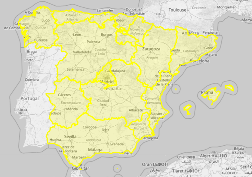
Example of province/region coverage in Spain with admin level 4:
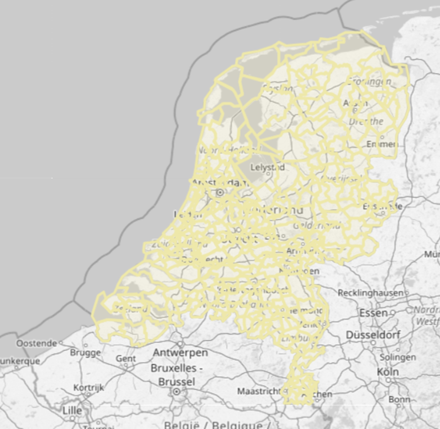
Example of municipality coverage of the Netherlands with admin level 8:
Example of bad coverage of Austria with admin level 8:
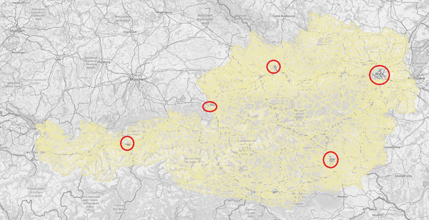
Places like Vienna present gaps. The municipality of Vienna is classified as administrative level 4, as it is considered a region in itself. Attempting to fill these gaps using administrative levels below 8 results in tiny polygons, overlaps, and awkward gaps.
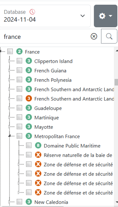
Additionally, I’ve observed issues with the hierarchy and areas in certain database dumps. For example, some recent dumps are missing administrative level 4 regions in specific countries, while in others, admin level 4 is entirely absent. This makes it impossible to generate region-level boundaries. See the example of France missing all its regions:
vs correct dump:
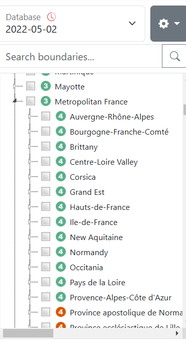
I hope some of you have encountered a similar challenge and can share your experiences! Thank you!


This is how the polygons has been created. If that's correct or not I do not know.
What you can do is right click an area where you have zero polygon data and choose "Select all enclosing polygons". You can by that way find out if there is some other less obvious polygon that covers that area. If you are lucky it's covering that area and nothing else. If not, one has to be creative by trying to merge and intersect polygon data. Sometimes it's just not solvable.